Friday, November 20, 2020

California State Capitol Sacramento

California State Capitol

Neoclassical California State Capitol main entrance. Compare this to the classical Roman temple below (Maison Caree in Nimes, France) also copied from the Greek style & built in 12 BC.


East Annex (added in 1952) is at the far right of photo.  The style has been called neo-fascist.

Interior of the rotunda. Photos taken in 2018.

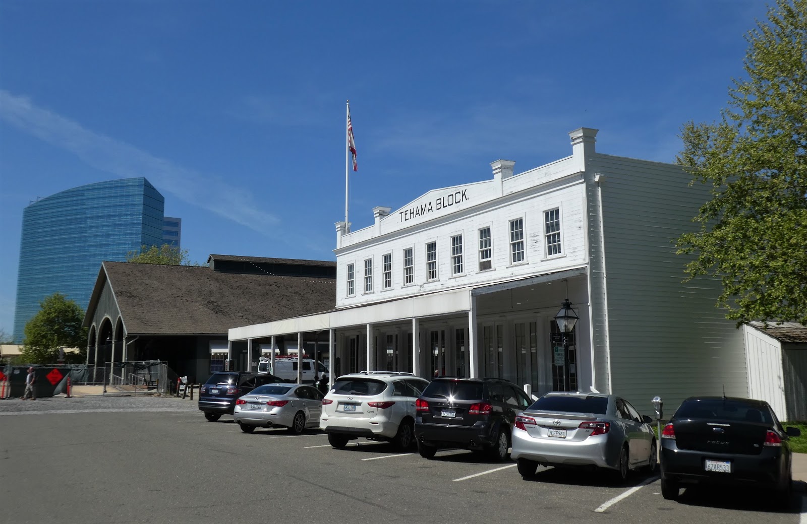
From my travel journal on 4-13-18: We got to Sacramento at 1, had Chinese food for lunch & walked around Downtown. We saw Downtown Commons, Cesar Chavez Square, Cathedral Square, K Street Mall, the California State Capitol Building & Capitol Park. Downtown Sacramento was not very impressive. It covered a small area. There were few people on the streets. Many buildings were empty, soon to be demolished & replaced. The tallest building had 43 floors & there were only 17 buildings over 20 floors. The renovation at Downtown Commons was almost finished & nicely done. Chavez Square was pleasing, the center of Downtown. The Capitol was a beautiful old building, partly a museum. The interior was lovely, especially the rotunda. 
 
The California State Capitol in Sacramento sits at the west end of Capitol Park, facing west on 10th Street between L St & N St. The California State Capitol was listed on the National Register of Historic Places in 1973 & named a California Historical Landmark in 1974. The neoclassical structure was built between 1861 & 1874 with major renovations between 1975 & 1982. Neoclassical architecture attempted to replicate the architectural style & details in ancient Greece. The building was based on the United States Capitol in Washington DC.  But the California State Capitol is smaller & better proportioned. The California Senate chamber seats 40 members. The California Assembly chamber is located at the opposite end of the building. Almost identical to the Senate chamber, it accommodates 80 members. Two new Capitol buildings were completed in 1928, the State Library & the Courts Building. The East Annex was completed in 1952, creating offices for the Governor, Lieutenant Governor, legislators & other state officials. It has quite a different, modern style.

Friday, November 6, 2020

Old Sacramento


Steel Bridge, a local landmark seen from Old Sacramento Waterfront. Photos taken in April 2018.

Click here for more photos of Old Sacramento.

From my travel journal on 4-9-18: We flew to Sacramento from Seattle & arrived before 11 AM. We rented a car. We drove to Robert Matsui Waterfront Park. The causeway to the modern, architecturally striking water intake structure was closed, but we could see it clearly from the riverbank. The Sacramento River was high from heavy rain 3 days before. Trees along the riverbank were standing in water. We drove a short distance to Old Sacramento, also on the Sacramento River Waterfront. It was a very charming area filled with shops & restaurants in wooden 19th century buildings, older than any in Seattle. It had an "Old West" feel with covered sidewalks of wooden boards.

Old Sacramento State Historic Park is a National Historic Landmark District. The City of Sacramento began at Sutter's Fort, more than 2 miles from the Sacramento River & more than 1 mile from the place Sutter's party landed on the south bank of the American River & established a camp in 1839. The settlers moved to Sutter's Fort in 1841. In 1848, gold was found during the construction of  a sawmill on the American River. People rushed to find gold & the fort was largely deserted by 1850. When the Gold Rush began, local merchant Sam Brannan opened a store near the Sacramento River. First called Sutter’s Embarcadero, it soon became the City of Sacramento. The city grew rapidly as a center for outfitting miners.

Old Sacramento Historic District covers the area between the river & Interstate 5, I St & the Capitol Mall.  It is a relatively small district of 8 short streets from 2 to 4 blocks long. Almost all the buildings date from the mid-19th century, beginning after the fire of 1852. After varying amounts restoration, they look much like they originally did. While the architecture is Victorian, some buildings have characteristics such as large arched doorways, full-height balcony windows & wrought-iron balconies that show a Spanish influence. The buildings are filled with restaurants, gift shops & other tourist businesses.  While the shops can be a bit tacky, the facades of the buildings & the district a whole seem quite authentic. Old Sacramento State Historic Park attracts over 5 million visitors annually.

Friday, October 16, 2020

Midtown Sacramento


Photos taken in April 2018

Click here for more photos of Midtown Sacramento.

From my travel journal on 4-13-18: We went for dinner at Jack’s Urban Eats in Midtown, then walked around that area & had gelato. There were several gay businesses there, but it was also the main business district for all of Midtown Sacramento: a large, vibrant commercial & residential area. There were many beautiful Victorian houses, some used as offices. There were a few large new apartment buildings similar to those in Seattle. There was a light rail system. We liked it very much. 4-14-18: At 7 AM, I walked for a mile from the motel, through Midtown, to the commercial area where we had been the night before. I took lots of photos. Our motel was at the edge of Midtown, which covers about 2 square miles. There was a street market that morning. I bought bread.

Midtown is the most attractive, interesting & vibrant neighborhood in Sacramento. It is adjacent to & east of Downtown.  It lies between R St & J St, 16th St & 30th St.  Most of the neighborhood is residential. The Victorian, Queen Anne & Craftsman homes are charming & mostly well-maintained. Midtown is Sacramento's main area for restaurants, bars, clubs, boutiques, art galleries & various small businesses.  They cluster between 18th & 21st, N & J streets & also spread east along J St to 27th St. The Midtown Farmers Market takes place year-round, every Saturday, on 20th St between J St & L St in the center of this business district. Sacramento's small LGBTQ entertainment district & community center is located nearby at K St & 20th St.

Starting around 1890, Sacramento began to spread east from 16th St to Alhambra Blvd. The J St & K St business corridors were extended from downtown. This area of mixed housing & business was later called Midtown. Buffalo Brewing started in 1890 at 21st St & Q St, the largest brewery west of the Mississippi. Sutter's Fort was restored & rebuilt from 1891 to 1893. It was designated a National Historic Landmark in 1961. Firehouse No. 3 was built in 1893 at 1215 19th St & listed on the National Register of Historic Places in 1991. Memorial Auditorium opened in 1927 at 15th St & J St. California Packing Corporation (CalPak) Plant #11 began operations in 1930 at 17th St & C St. Sutter Memorial Hospital opened in 1937 as Sutter Maternity Hospital at 29th St & Capitol Ave.

The Capitol Mansions Historic District is located in Midtown between 22nd St & 27th St, Kayak Alley (between Capitol Ave & L St) & Matsui Alley (between Capitol Ave & N St). It is a group of more than 150 large, stately structures that were originally single-family residences. The features, characteristics & materials of the structures are consistent with Queen Anne & Classic Box/Foursquare homes. The latter is a sub-type of Colonial Revival homes, built prior to 1915. More than 150 structures were listed when Capitol Mansions became a historic district in 2004.

Friday, October 2, 2020

Sacramento Old City Cemetery


Photos taken in April 2018

From my travel journal on 4/14/18: We drove to the Old Sacramento City Cemetery, part of our tour of Sacramento. It was beautiful. I had never seen a cemetery with so many trees, shrubs & flowers. Lots of people were wandering around. There was a plant sale & a guided tour. Many gravestones were more than 100 years old. There was a special plot for governors of the State of California & other elected officials.

According to the City of Sacramento website: the Old City Cemetery is wonderful place to visit. It is an outdoor museum containing historical grave sites & statues, beautiful landscaping, roads & walking paths. I completely agree with this assessment. The City of Sacramento owns the 40-acre cemetery. It is the oldest existing cemetery in Sacramento, established in 1849 when Sacramento founder & planner John Augustus Sutter, Jr. donated the first 10 acres. Another 23 acres were donated by Sacramento legend Margaret Rhodes Crocker in 1880. In 1856, the first cemetery superintendent was hired & began to plan & landscape the grounds in the Victorian style of that era. Many sections are contained by brick or concrete retaining walls that create level terraces for planting. The cemetery was declared a State Historic Landmark in 1957 by the State Historical Landmarks Commission.

A Cemetery Master Plan was adopted by the Sacramento City Council in 2007. The rose garden was planted in the early 1990’s throughout the Cemetery. Each plot or gravesite is landscaped, most with various perennials & shrubs including roses, but some with only turf. 

In 2014, the cemetery was listed the in National Register of Historic Places, with significance designation at the state & local level as follows: “The site is eligible under Criterion B at the national level of significance for its association with cemetery benefactor Margaret Crocker and as the gravesite of multiple Sacramentans of transcendent importance for whom there is no other surviving property associated with their productive lives. The site is eligible at the state level of significance as an example of Victorian era "rational" cemetery planning, and as an assemblage of significant examples of funerary architecture, statuary and landscape design. It draws its significance from graves of persons of transcendent importance, age, distinctive design features, and association with historic events.”

Sacramento city code strictly protects the cemetery landscape: No person, except an authorized City Employee in the course and scope of his or her assigned duties, shall: (a) plant any tree, shrub, plant, or flower on the grounds of the City Cemetery without prior approval from the Cemetery Manager. This subsection does not prohibit the placement of cut, artificial, or potted flowers upon a grave; (b) cut, break, pluck, remove, or in any manner destroy or injure any tree, shrub, plant, or flower within the City Cemetery grounds without prior approval from the Cemetery Manager. This section does not prohibit the removal of weeds and dead vegetation by an authorized City employee, a person or business entity that has received approval as provided in paragraph (f) of this section, or an owner of a private plot, in the course of providing care and upkeep of plots.

Friday, September 18, 2020

UC Davis Arboretum


Photos taken in April 2018

Click here for more photos of UC Davis Arboretum.

From my travel journal on 4/14/18: We drove to Davis, a city 17 miles west of Sacramento. We had Chinese food for lunch. There were many Chinese students from the University of California at Davis eating & working there. We drove around downtown Davis. It was lively, but not very charming. We went to the UC Davis Arboretum. It was very nice, covering 100 acres along the banks of Putah Creek, old north channel. Fortunately, it was mostly shaded, because it was sunny & warm that day.

Putah Creek flows 85 miles from the eastern slope of Cobb Mountain in the Coast Range to the Sacramento River. The name comes from Miwok people who lived near the creek. Puṭa wuwwe is said to mean grassy creek. Putah Creek flowed through the old north channel until it was redirected south in 1871.

The UC Davis Arboretum was founded in 1936. The arboretum’s collections include 22,000 trees & plants adapted to the local climate. The property is open to the public with walking & biking trails, picnic areas & wildlife viewing. The arboretum can be entered in many places. It is used for research by UC Davis faculty, students & others. It supports teaching at UC Davis with courses in many different disciplines using the arboretum. The arboretum has more than 20 different gardens featuring plants from California & countries with similar summer-dry climates across the globe. Visitors can learn about best practices in sustainable horticulture.

For thousands of years, this land has been the home of Patwin people, neighbors of the Miwok people. The Patwin people have remained committed to the stewardship of this land. The UC Davis campus is Patwin land & remains an important part of Patwin heritage & identity. The Native American Contemplative Garden recognizes this.

Friday, September 4, 2020

Oak Grove Regional Park Stockton


Photos taken in April 2018

Click here for more photos of Oak Grove Regional Park.

After breakfast at the motel in Sacramento, we drove to Oak Grove Regional Park in Stockton. We walked in the oak grove for almost 2 hours. There were dozens of large, old valley oaks (Quercus lobata). The trees were larger than any oak I’d seen in California before. The ground was covered with grasses & a few shrubs such as elderberry (Sambucus). We saw Canada geese, hawks & ground squirrels. Although there is housing development surrounding the park & infrastructure within the park, I didn't notice much but the oaks, the grass & the hawks high in the sky above.

Oak Grove Regional Park, between Stockton & Lodi (4520 West Eight Mile Road, Stockton) has an area of 180 acres. Two nature trails provide a 1.5 mile walk in the grove: the Yokuts Trail & the Miwok Trail. The shorter Yokuts Trail features native plants.  The much longer Miwok Trail winds through the oak grove. Oak Grove Nature Center focuses on wildlife, habitats & the native inhabitants of the area: the Miwok & Yokuts peoples. Oak Grove Regional Park is one of very few woodlands remaining in the California Central Valley.

Native Americans lived in the Central Valley for thousands of years before the town of Stockton was built. When Europeans arrived, they found the Yatchicumne, a group of Northern Valley Yokuts people, living in the Stockton area. The Yokuts built their villages on low mounds to avoid the regular flooding. A Yokuts village was located on a mound in what is now downtown Stockton. The number of Yokuts, whose settlements stretched 250 miles from the confluence of the Sacramento & San Joaquin rivers to the Tehachapi Mountains, is estimated at 18,000 to 50,000. They gathered acorns & ground Tule reeds into meal.  The reeds were also used to make baskets & mats that covered their dwellings. The Miwok inhabited lands to the north.  

The number of Native Americans in the San Joaquin Valley began to dwindle after their first contact the Spanish arrived in 1769.  Between 1805 & 1825, Franciscan priests persuaded many of them to move to the Santa Clara, San Jose, San Juan Batista & San Antonio missions. Those missions were mostly abandoned after an epidemic in 1833 killed 75% of the native population. During the Gold Rush of 1848, American settlers forced the remaining Yokuts from their lands.

The San Joaquin & Sacramento valleys join where the Sacramento & San Joaquin Rivers flow through Carquinez Strait to San Francisco Bay. Stockton lies at the southern edge of the the Sacramento Delta at the confluence of the San Joaquin & Calaveras Rivers. The Central Valley is an elongated depression (430 long & 75 miles wide) between the Coast Ranges & the Sierra Nevada. At its center, east of San Francisco Bay, it is slightly below sea level. The Central Valley is 2 joined valleys: the Sacramento Valley, drained by the Sacramento River & the San Joaquin Valley, drained by the San Joaquin River. The confluence of these two rivers forms the Sacramento-San Joaquin Delta, formerly a massive wetland, now a major agricultural area.

The Central Valley contained 3 primary communities of plants & animals: Valley Grassland, Freshwater Marsh, & Riparian Woodland. Woodlands grew in the Delta & along the rivers. In the mid-1800s, woodlands covered about a million acres of the Central Valley. Today they cover only about 100,000 acres. The disappearance of woodland is attributed to overgrazing by domestic animals beginning with cattle & sheep introduced by the Spanish & continued by American settlers.  Woodland trees include Western Sycamore (Platanus racemosa), Box Elder (Acer negundo) Fremont Cottonwood (Populus fremontii) & 3 species of willow. The most impressive tree is the Valley Oak (Quercus lobata).

Friday, August 21, 2020

Merced Wild and Scenic River


Cercis occidentalis (Western Redbud)


Cercis occidentalis (Western Redbud)


Photos taken in April 2018

Click here for more photos of Merced Wild and Scenic River.

From our resort near Yosemite National Park, we drove a few miles up HWY 140 to the Merced River Trail. I loved it. The river was beautiful & the banks were filled with an abundance of plants, vibrant with new growth & many flowers. I was fascinated by the California native plants I had studied in landscape design school in San Francisco. The weather was cool & partly cloudy. We walked for 3 hours on a dirt road with no cars 

The Merced is designated a wild & scenic river under the Wild & Scenic Rivers Act of 1968 by the US Congress. It is one of 11 wild & scenic rivers in California. There is a variety of native, endemic &/or rare plant species along the river with many small meadows & riparian habitats. The river begins high in the Sierra Nevada Mountains. It flows through Yosemite National Park & on to the Sacramento Valley where it joins the San Joaquin River. 8 miles of the lower Merced River from Briceburg downstream to Bagby (near Yosemite National Park) received wild & scenic status in 1992.  3 of those miles are wild, the only wild (most pristine) segment outside Yosemite National Park. That section of the river ends when it joins lake McClure above Bagby. 

The Merced River along Highway 140 (outside the park) is designated recreational. This segment of the river provides access to the free-flowing river & makes HWY 140 the most scenic route into Yosemite National Park. We had easy access to walk along this part of the river by turning off HWY 140 at Briceburg Rd, crossing a suspension bridge, parking in a small lot near the river & the highway 16 miles below the Arch Rock Entrance to Yosemite National Park.

Friday, August 7, 2020

Hetch Hetchy Valley

Hetch Hetchy Valley below the dam

O'Shaughnessy Dam

Water flowing from the dam

Hetch Hetchy Reservoir (more than 300 feet deep)

Digger pine cone (Pinus sabiniana)

South rim of the valley above the dam. Photos taken in April 2018

Click here for more photos of Hetch Hetchy Valley.

Our last day in Yosemite National Park was April 12, 2018. After walking in Tuolumne Grove, we took a lovely drive to Hetch Hetchy Valley.  It was beautiful. We couldn’t walk in the valley, because it is filled with a reservoir that provides the San Francisco Bay Area with water. But we could see it from above & from the top of the impressive dam. The Hetch Hetchy Road runs down to the dam, near the western edge of park.  The reservoir fills the valley to the east for 8 miles.

The valley was even more beautiful before the dam was built. The bottom of the valley had 1,200 acres of meadows surrounded by a forest of pine, oak & Douglas fir. The Tuolumne River & many streams flowed through the valley, while stands of alder, willow & dogwood grew among them. More than 300 feet of the valley walls had not yet been covered by water.

Work on the Hetch Hetchy Project began in 1914 when the Hetch Hetchy Railroad (68 miles long) was built to bring construction materials to the dam site. It was dismantled in 1949. Construction of O'Shaughnessy Dam began in 1919 & ended in 1923. The height of the dam was increased from 227 to 312 feet in 1938. The aqueduct system brought water to San Francisco in 1934 after flowing 167 miles from Hetch Hetchy Valley.

San Francisco was granted water rights to Hetch Hetchy Valley by the United States Department of the Interior in 1908.  The Sierra Club (led by John Muir) began a campaign to stop the project.  National opinion was divided between damming & preserving Hetch Hetchy Valley. Conservationists felt the environment should be used in a "conscientious manner" to benefit society.  Preservationists believed that nature should be preserved & protected. San Francisco argued that the reservoir was vital to the city. John Muir asked Congress to protect Hetch Hetchy Valley from destruction. Hundreds of individuals & organizations sent petitions to Congress. It was the beginning of the American environmentalist movement.

Because the valley was in Yosemite National Park, an act of Congress was required. The Raker Act was passed in 1913 & signed by President Woodrow Wilson. It permitted the flooding of the valley, but stipulated that power & water could only be used for public interests.

In 1921, Principal Jessie Lockwood was asked to select a new name for the York School that had opened in 1910 in the Mt Baker neighborhood of Seattle. She chose John Muir. Part of her motivation for selecting Muir was the hope that students would develop a love of nature & a desire to conserve natural beauty.  Ironically, I attended that school for 7 years, but learned nothing about John Muir or environmentalism during that time.