Friday, February 26, 2021

King Street Station Seattle


Photos above taken in 2018

Photo taken in 2017

King Street Station was built between 1904 & 1906 using concrete, granite, & brick.  The structure was financed by James J Hill who controlled Great Northern Railway & the Northern Pacific Railway. It was Seattle's 1st substantial passenger station, replacing a much smaller wooden building closer to the waterfront. A series of renovations in the mid-20th century removed marble walls & glass mosaic tiles, boarded up windows & replaced doors. The ceiling was lowered with a hanging framework of acoustical tiles & fluorescent light panels.  It reminded me of my junior high school, built in 1957.  That was the state of King Street Station as I greeted my grandma when she came to visit from Montana in the 1960s & 70s: shabby & unattractive.  I was amazed when I saw the restored interior in 2018. 

Increasing use from Sounder (commuter) & Amtrak (long-distance) passengers led to the improvement of King Street Station.  It was included in the Pioneer Square-Skid Road National Historic District in 1970 & listed on the National Register of Historic Places in 1973.  The City of Seattle purchased the property from the Burlington Northern & Santa Fe Railroad in 2008 for $10.  The BNSF Railroad carried freight only & leased the passenger facility to Amtrak & Sound Transit. The station's designation as a historic place prevented it from being demolished & replaced. The restoration project was completed in 2013 at a cost more than $55 million. 

In 2018, King Street Station had 25 daily train departures: 13 Sounder commuter trains south to Tacoma with 8 trains continuing to Lakewood (weekdays only). 4 Sounder commuter trains north to Everett (weekdays only). 2 Amtrak Cascades regional trains north to Vancouver. 4 Amtrak Cascades regional trains south to Portland with one train continuing to Eugene. 1 Amtrak Empire Builder long-distance train east to Chicago. 1 Amtrak Coast Starlight long-distance train south to Los Angeles.

Friday, February 12, 2021

Pioneer Building Seattle

South facade

West facade

with the Smith Tower.  Photos above taken in 2018

with the Pergola

with the Totem Pole. 2 photos above taken in 2014

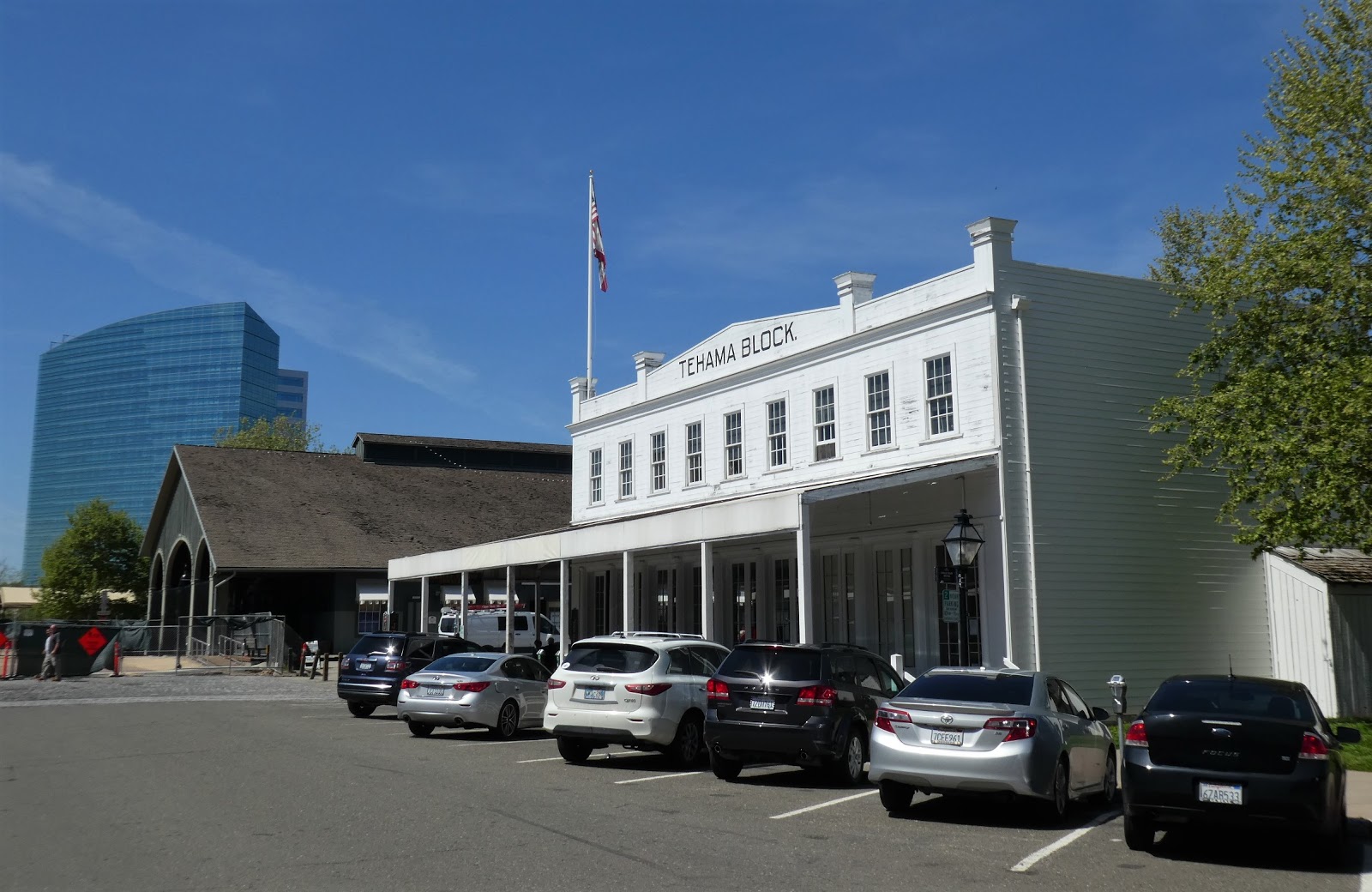
The Pioneer Building is located at 600 1st Ave in Pioneer Square in Seattle.  It was built in the Richardsonian Romanesque style with a facade of Bellingham Bay gray sandstone, red brick, terra cotta, & cast iron bays.  The building can be considered a transition between Victorian & Romanesque Revival styles.  Completed in 1892, the Pioneer Building was designed by architect Elmer Fisher, who designed several Pioneer Square buildings after the Great Fire of 1889.  It was the first of 3 buildings built by Seattle pioneer Henry Yesler & stands on the ground where Yesler built his 1st sawmill in 1853.  It was constructed with permanent partitions forming 185 office rooms.  Natural light flows into the interior through 2 atria.  The building became an important business location.  During the Klondike Gold Rush in 1897, there were 48 mining company offices there.  The Pioneer Building was added to the National Register of Historic Places in 1970.  It was completely rehabilitated in 1973, then renovated in 1980 & 2016.  It has always been an office building.  The Underground Seattle Tours ticket office has been located in the Pioneer Building for many years.  

In June of 2020, these offices were listed for rent in the Pioneer Building:

1. Great one person office overlooking the co-working lounge. The Pioneer Building is located in the center of the cultural hub of Seattle. Walkable to abundant restaurants, cafes, antique shops, bookstores & boutiques, Pioneer Square is a vibrant neighborhood close to all major public transportation. 

2. 5th floor office with gorgeous south-facing view. With a peek at Century Link Field & walls with charming brick detail, this suite is great for companies with 8 to 15 employees. This comes with a conference room, kitchen, 2 large offices & open work space. The Pioneer Building is a historic landmark outstanding for its importance in Seattle's oldest business district & for the beauty of its architecture.

Right in front of the Pioneer Building is the small park called Pioneer Square, which is confusing because the whole neighborhood is called Pioneer Square.  It's not officially called Pioneer Square Park (which might help) & it's not even square, it's triangular.  It used to be called Pioneer Place.  Why did they change the name?  In Pioneer Square (the park) you can see a Tlingit totem pole, a bust of Chief Seattle, & Day/Night (two enamel-on-steel panels with Chief Seattle quotations in English & Lushootseed, created by Edgar Heap of Birds).  Best of all, you can see the Pioneer Square Pergola, a national historic landmark.

Friday, January 22, 2021

Smith Tower Seattle

 
Photos above taken in 2014


Photos above taken in November 2018

The Smith Tower is oldest skyscraper (38 floors, 469 feet) in the city.  Built between 1911 & 1914, it was the tallest building west of the Mississippi River until 1931 & tallest on the West Coast until the Space Needle was built in 1962. It's named after its builder:  Lyman Cornelius Smith. Smith originally planned on a 14-story building.  But his son convinced him to build taller than the National Realty Building in Tacoma, the tallest west of the Mississippi River at that time. Designated as a Seattle landmark in 1984, it is a lofty example of neoclassical architecture.  The surface is granite to the 2nd floor, then gleaming white terracotta from the 3rd floor on up.  The building has had a number of owners including Ivar Haglund, founder of Ivar's restaurants. It has been renovated several times.  The 35th-floor observation deck (near the top) has a 360-degree view of downtown, SoDo, Elliott Bay & more.  (The Space Needle has broader views, with the viewing deck at 518 feet, but the Smith Tower is less expensive & much less crowded.)  I went to the top of the Smith Tower for the 1st time with my Cub Scout den in 1968, many thanks to Mrs. del Fierro.  I have gone back twice.  At the top of the Smith Tower is a pyramid with a 1,750-square-foot, 2 bedroom, 2 bathroom apartment.  Last I heard, people lived in it.  The observation deck is just below the pyramid.

Friday, January 8, 2021

Pioneer Square Seattle


The Pioneer Square Pergola was built in 1909 as cable car stop. In January 2001, the iron & glass structure collapsed when it was hit by a truck. It was replaced in August 2002.

The Pioneer Building was completed in 1892. 4 photos above taken in January 2014

King Street Station was built in 1904-06. The clocktower was inspired by St Mark's Campanile in Venice. Photo taken in June 2017


3 photos above taken in December 2017

Click here for more photos of Pioneer Square.

Pioneer Square is one of my favorite places in Seattle.  It's popular with Seattleites & also a popular tourist attraction.  Many people live & work there.  Shops & restaurants cater to locals more than to tourists, even during the short tourist season.  Pioneer Square's derelict period ended many years ago.  It is now more urban chic.      

The area now called Pioneer Square became Seattle's first permanent American settlement in 1852. It was the only sizable piece of level ground on Elliott Bay.  It developed quickly into a residential & business district of wooden buildings.  Those were all destroyed in the Great Fire of 1889.  It was quickly rebuilt as the central business district by 1892 with brick & stone buildings in the Richardsonian Romanesque style popular in the United States from 1885 to 1905. Pioneer Square has one of the best surviving collections of Richardsonian Romanesque commercial architecture in the US & became a National Historic District in 1970.  An interesting feature of Pioneer Square is the Seattle Underground which can be explored in the Underground Tour. Because the area was built on low ground, high tides sometimes filled the streets, which were raised by one level.  That turned the former 1st floors into basements with front doors, windows, signage & sidewalks still intact. 

Pioneer Square peaked during the Klondike Gold Rush (1896-99) then fell into decline. By the 1920s, it was seen as the southern part of downtown, rather than Seattle’s main commercial center. It became a district of taverns & seedy hotels. The city government reversed that decline when it named Pioneer Square Preservation District as Seattle's first such district in May 1970. The Pioneer Square-Skid Road Historic District was listed in the National Register of Historic Places in June 1970. The neighborhood takes its name from a small triangular plaza near the corner of First Ave & Yesler Way, originally known as Pioneer Place. Yesler Way was known as "skid road" during the early days of settlement when logs were skidded down the steeply sloping road to the Yesler Sawmill located on Elliott Bay. It is the likely origin of the term "skid row" from the seedy period of Pioneer Square.

Significant structures & sites in Pioneer Square: 

Grand Central Building 216 1st Avenue S: It was built in 1889-90 as an office building & converted to the Grand Central Hotel during the Klondike Gold Rush in 1897.  It was renovated 1971 as an office building with the Grand Central Bakery (established 1972) & other shops on the ground level.

King Street Station 303 South Jackson St: It was built in 1904-06 by the Great Northern Railway & Northern Pacific Railway.  It was most recently renovated in 2013, restoring its original fixtures. Inside the main entry, at the base of the clock tower, is the main hall, known as the Compass Room. Its ceiling resembles one at the Palazzo Vecchio in Florence.  It is served by 3 Amtrak routes & commuter trains run by Sound Transit.

Klondike Gold Rush National Historical Park
319 2nd Ave S: A museum located in the Cadillac Hotel, an 1889 building that was a major point of outfitting & departure during the gold rush.

Merchants Cafe 109 Yesler Way: Seattle's oldest restaurant opened in 1890.

Occidental Square 117 S Washington St: A 0.6 acre public park located between the 19th-century Grand Central Building & the 21st-century Weyerhaeuser Company Headquarters.  In summer, it's filled with park furniture, bocce courts, ping pong tables, occasional festivals & crafts markets.

Pioneer Building 600 1st Ave: One of the most impressive of the historic structures in Pioneer Square, it was built in 1889-92.  It is 94 feet tall with a beautiful facade.  It was listed as a National Historic Landmark in 1977.  It stands behind the Pioneer Square Pergola & totem pole.  You can buy tickets for the Seattle Underground Tour there. It was built as & remains an office building.

Pioneer Square Pergola at 1st Avenue & Yesler Way: The small park also includes a totem pole & plaza with benches in front of the Pioneer Building.

Smith Tower 506 2nd Ave: The oldest skyscraper in the city (38 floors) was built 1911-14.  It was the tallest building on the West Coast until 1962.  Designated as a Seattle landmark in 1984, it is a lofty example of neoclassical architecture.  The surface is granite to the 2rd floor, then gleaming white terracotta from the 3rd floor on up. The observation deck near the top has a 360-degree view of 
downtown, SoDo, Elliott Bay & more.

Union Station 401 S Jackson St: Built in 1910-11, 3 train lines used this station until 1971.  Then it was unused until an expansive renovation was finished in 1999.  The renovation won the 2000 National Historic Preservation Award. The beautiful Great Hall is open to the public during business hours.  Union Station is now the headquarters of Sound Transit.

UPS Waterfall Garden Park 2nd Ave & Main St: The small private park was created in 1978 at the site of the original UPS (United Parcel Service) building.  It is open to the public during the day.  The Japanese-style garden has a 22-foot tall waterfall flowing at 5,000 gallons per minute.  It is one of the most expensive parks per square foot built in the US.


Friday, November 20, 2020

California State Capitol Sacramento

California State Capitol

Neoclassical California State Capitol main entrance. Compare this to the classical Roman temple below (Maison Caree in Nimes, France) also copied from the Greek style & built in 12 BC.


East Annex (added in 1952) is at the far right of photo.  The style has been called neo-fascist.

Interior of the rotunda. Photos taken in 2018.

From my travel journal on 4-13-18: We got to Sacramento at 1, had Chinese food for lunch & walked around Downtown. We saw Downtown Commons, Cesar Chavez Square, Cathedral Square, K Street Mall, the California State Capitol Building & Capitol Park. Downtown Sacramento was not very impressive. It covered a small area. There were few people on the streets. Many buildings were empty, soon to be demolished & replaced. The tallest building had 43 floors & there were only 17 buildings over 20 floors. The renovation at Downtown Commons was almost finished & nicely done. Chavez Square was pleasing, the center of Downtown. The Capitol was a beautiful old building, partly a museum. The interior was lovely, especially the rotunda. 
 
The California State Capitol in Sacramento sits at the west end of Capitol Park, facing west on 10th Street between L St & N St. The California State Capitol was listed on the National Register of Historic Places in 1973 & named a California Historical Landmark in 1974. The neoclassical structure was built between 1861 & 1874 with major renovations between 1975 & 1982. Neoclassical architecture attempted to replicate the architectural style & details in ancient Greece. The building was based on the United States Capitol in Washington DC.  But the California State Capitol is smaller & better proportioned. The California Senate chamber seats 40 members. The California Assembly chamber is located at the opposite end of the building. Almost identical to the Senate chamber, it accommodates 80 members. Two new Capitol buildings were completed in 1928, the State Library & the Courts Building. The East Annex was completed in 1952, creating offices for the Governor, Lieutenant Governor, legislators & other state officials. It has quite a different, modern style.

Friday, November 6, 2020

Old Sacramento


Steel Bridge, a local landmark seen from Old Sacramento Waterfront. Photos taken in April 2018.

Click here for more photos of Old Sacramento.

From my travel journal on 4-9-18: We flew to Sacramento from Seattle & arrived before 11 AM. We rented a car. We drove to Robert Matsui Waterfront Park. The causeway to the modern, architecturally striking water intake structure was closed, but we could see it clearly from the riverbank. The Sacramento River was high from heavy rain 3 days before. Trees along the riverbank were standing in water. We drove a short distance to Old Sacramento, also on the Sacramento River Waterfront. It was a very charming area filled with shops & restaurants in wooden 19th century buildings, older than any in Seattle. It had an "Old West" feel with covered sidewalks of wooden boards.

Old Sacramento State Historic Park is a National Historic Landmark District. The City of Sacramento began at Sutter's Fort, more than 2 miles from the Sacramento River & more than 1 mile from the place Sutter's party landed on the south bank of the American River & established a camp in 1839. The settlers moved to Sutter's Fort in 1841. In 1848, gold was found during the construction of  a sawmill on the American River. People rushed to find gold & the fort was largely deserted by 1850. When the Gold Rush began, local merchant Sam Brannan opened a store near the Sacramento River. First called Sutter’s Embarcadero, it soon became the City of Sacramento. The city grew rapidly as a center for outfitting miners.

Old Sacramento Historic District covers the area between the river & Interstate 5, I St & the Capitol Mall.  It is a relatively small district of 8 short streets from 2 to 4 blocks long. Almost all the buildings date from the mid-19th century, beginning after the fire of 1852. After varying amounts restoration, they look much like they originally did. While the architecture is Victorian, some buildings have characteristics such as large arched doorways, full-height balcony windows & wrought-iron balconies that show a Spanish influence. The buildings are filled with restaurants, gift shops & other tourist businesses.  While the shops can be a bit tacky, the facades of the buildings & the district a whole seem quite authentic. Old Sacramento State Historic Park attracts over 5 million visitors annually.

Friday, October 16, 2020

Midtown Sacramento


Photos taken in April 2018

Click here for more photos of Midtown Sacramento.

From my travel journal on 4-13-18: We went for dinner at Jack’s Urban Eats in Midtown, then walked around that area & had gelato. There were several gay businesses there, but it was also the main business district for all of Midtown Sacramento: a large, vibrant commercial & residential area. There were many beautiful Victorian houses, some used as offices. There were a few large new apartment buildings similar to those in Seattle. There was a light rail system. We liked it very much. 4-14-18: At 7 AM, I walked for a mile from the motel, through Midtown, to the commercial area where we had been the night before. I took lots of photos. Our motel was at the edge of Midtown, which covers about 2 square miles. There was a street market that morning. I bought bread.

Midtown is the most attractive, interesting & vibrant neighborhood in Sacramento. It is adjacent to & east of Downtown.  It lies between R St & J St, 16th St & 30th St.  Most of the neighborhood is residential. The Victorian, Queen Anne & Craftsman homes are charming & mostly well-maintained. Midtown is Sacramento's main area for restaurants, bars, clubs, boutiques, art galleries & various small businesses.  They cluster between 18th & 21st, N & J streets & also spread east along J St to 27th St. The Midtown Farmers Market takes place year-round, every Saturday, on 20th St between J St & L St in the center of this business district. Sacramento's small LGBTQ entertainment district & community center is located nearby at K St & 20th St.

Starting around 1890, Sacramento began to spread east from 16th St to Alhambra Blvd. The J St & K St business corridors were extended from downtown. This area of mixed housing & business was later called Midtown. Buffalo Brewing started in 1890 at 21st St & Q St, the largest brewery west of the Mississippi. Sutter's Fort was restored & rebuilt from 1891 to 1893. It was designated a National Historic Landmark in 1961. Firehouse No. 3 was built in 1893 at 1215 19th St & listed on the National Register of Historic Places in 1991. Memorial Auditorium opened in 1927 at 15th St & J St. California Packing Corporation (CalPak) Plant #11 began operations in 1930 at 17th St & C St. Sutter Memorial Hospital opened in 1937 as Sutter Maternity Hospital at 29th St & Capitol Ave.

The Capitol Mansions Historic District is located in Midtown between 22nd St & 27th St, Kayak Alley (between Capitol Ave & L St) & Matsui Alley (between Capitol Ave & N St). It is a group of more than 150 large, stately structures that were originally single-family residences. The features, characteristics & materials of the structures are consistent with Queen Anne & Classic Box/Foursquare homes. The latter is a sub-type of Colonial Revival homes, built prior to 1915. More than 150 structures were listed when Capitol Mansions became a historic district in 2004.

Friday, October 2, 2020

Sacramento Old City Cemetery


Photos taken in April 2018

From my travel journal on 4/14/18: We drove to the Old Sacramento City Cemetery, part of our tour of Sacramento. It was beautiful. I had never seen a cemetery with so many trees, shrubs & flowers. Lots of people were wandering around. There was a plant sale & a guided tour. Many gravestones were more than 100 years old. There was a special plot for governors of the State of California & other elected officials.

According to the City of Sacramento website: the Old City Cemetery is wonderful place to visit. It is an outdoor museum containing historical grave sites & statues, beautiful landscaping, roads & walking paths. I completely agree with this assessment. The City of Sacramento owns the 40-acre cemetery. It is the oldest existing cemetery in Sacramento, established in 1849 when Sacramento founder & planner John Augustus Sutter, Jr. donated the first 10 acres. Another 23 acres were donated by Sacramento legend Margaret Rhodes Crocker in 1880. In 1856, the first cemetery superintendent was hired & began to plan & landscape the grounds in the Victorian style of that era. Many sections are contained by brick or concrete retaining walls that create level terraces for planting. The cemetery was declared a State Historic Landmark in 1957 by the State Historical Landmarks Commission.

A Cemetery Master Plan was adopted by the Sacramento City Council in 2007. The rose garden was planted in the early 1990’s throughout the Cemetery. Each plot or gravesite is landscaped, most with various perennials & shrubs including roses, but some with only turf. 

In 2014, the cemetery was listed the in National Register of Historic Places, with significance designation at the state & local level as follows: “The site is eligible under Criterion B at the national level of significance for its association with cemetery benefactor Margaret Crocker and as the gravesite of multiple Sacramentans of transcendent importance for whom there is no other surviving property associated with their productive lives. The site is eligible at the state level of significance as an example of Victorian era "rational" cemetery planning, and as an assemblage of significant examples of funerary architecture, statuary and landscape design. It draws its significance from graves of persons of transcendent importance, age, distinctive design features, and association with historic events.”

Sacramento city code strictly protects the cemetery landscape: No person, except an authorized City Employee in the course and scope of his or her assigned duties, shall: (a) plant any tree, shrub, plant, or flower on the grounds of the City Cemetery without prior approval from the Cemetery Manager. This subsection does not prohibit the placement of cut, artificial, or potted flowers upon a grave; (b) cut, break, pluck, remove, or in any manner destroy or injure any tree, shrub, plant, or flower within the City Cemetery grounds without prior approval from the Cemetery Manager. This section does not prohibit the removal of weeds and dead vegetation by an authorized City employee, a person or business entity that has received approval as provided in paragraph (f) of this section, or an owner of a private plot, in the course of providing care and upkeep of plots.