Pages

Friday, January 31, 2014

Martin Luther King, Jr. Memorial Park

Martin Luther King, Jr. Memorial Park, with Beacon Hill on the horizon, in July 2013


Martin Luther King, Jr. Memorial Park, with Downtown Seattle in the distance, in July 2013

Martin Luther King, Jr. Memorial Park, with Mt Baker Ridge above, in July 2013

The Martin Luther King, Jr. Memorial Park is located at 2200 Martin Luther King, Jr. Way S, covering 4.3 acres on the west slope of Mt Baker Ridge, in the Mt Baker neighborhood.  The memorial sculpture/fountain & surrounding pool sits in the Rainier Valley.  It represents a mountain, which was inspired by the civil rights leader's last speech, delivered in Memphis on April 3, 1968: I've Been to the Mountaintop

Robert Kelly designed the sculpture and fountain.  It was dedicated on November 16, 1991.  The land behind the memorial is terraced to form an amphitheater.  Protests, demonstrations & rallies are staged at the memorial.  But it appears to be seldom used or visited.  It is clearly visible to traffic on Martin Luther King, Jr. Way S.  The landscaping here in uninspired & the views are unspectacular.

Martin Luther King, Jr. visited Seattle once from November 8 to November 10, 1961.  He spoke at the University of Washington, Temple de Hirsch, Garfield High School & the Eagles Auditorium.  In his lectures, the civil rights leader stressed creative protest to break down racial segregation & discrimination, & called on President John F. Kennedy to use the executive order to declare all segregation unconstitutional.


Friday, January 24, 2014

Heather Lake Trail

Heather Lake July 2012 

Avalanche at Heather Lake July 2012

Pedicularis groenlandica (Elephant's Head) at Heather Lake July 2012

Heather Lake July 2012

Lilium columbianum (Tiger Lily) at Heather Lake July 2012

Click here to see more photos of the Heather Lake Trail.

Although the forest along the Heather Lake Trail is varied & lovely, the amazing natural garden contained in the glacial cirque surrounding Heather Lake is truly amazing.  At the end of July, the last patches of snow were melting.  Some plants were just emerging from the ground.  Wildflowers were blooming everywhere.  At midsummer, it was spring recapitulated.  It was the most beautiful, diverse & abundant collection of flora I had seen in the Cascade Mountains.  The broken trees & piles of snow that remained from several avalanches were also quite interesting.  The Heather Lake Trail was easily the most impressive of the 10 hikes I made along the Mountain Loop Highway during the summer of 2012.  This trail starts at 1,400 feet in elevation & climbs to 2,500 feet (800 meters) in the subalpine zone.  It is 4.6 miles round trip, not a particularly difficult hike.

Friday, January 17, 2014

Alki Beach at Sunset

Landscaping along Alki Avenue SW.  Alki is a word from the Chinook Jargon meaning 'by and by'.  Seattle's first white (American) settlers landed here in 1851.

A diminutive Statue of Liberty.

Duwamish Head with the Space Needle beyond.

Puget Sound, the Kitsap Peninsula & the Olympic Mountains.

 Alki Beach Park.  All photos were taken in May 2013.

Alki Beach Park is located at Alki Beach, on Elliott Bay, on Puget Sound, in West Seattle.  This is probably the most popular salt-water beach park in the City of Seattle.  It is especially crowded on warm summer days & evenings, when people picnic on the imported sand, play volleyball & walk on the promenade.  Puget Sound beaches are mostly rocky.  The pathway extends from Alki Point, past Duwanish Head to the Duwamish Waterway.  Few people swim, since Puget Sound is perpetually cold, never exceeding 56F/13C, even in summer.  In spring & fall, there are walkers, bicyclists & skate boarders.  It can be especially charming at sunset, as the light fades behind the Olympic Mountains.  There are a number of restaurants across from the beach along Alki Avenue SW.  Views include the Kitsap & Olympic peninsulas, Downtown Seattle, Queen Anne Hill & Magnolia Bluff.

Friday, January 10, 2014

December in Seattle

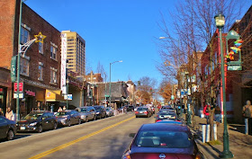
University Way NE, also known as The Ave.

NE 45th Street at the corner of University Way NE, the busiest intersection on The Ave.  Hotel Deca appears at the upper left.

Women spray-painting a wreath of twigs in an alley off NW 45th Street.

The bus stop on Campus Parkway NE.  The buildings shown here are student housing for the University of Washington.

An academic building on the University of Washington campus.

December in Seattle was colder & much drier than normal.  The mean temperature was 39.7F/4.27C.  The normal mean temperature is 40.6F/4.78C.  Total precipitation was 1.66 inches/42.16mm.  Normal precipitation is 5.35 inches/135.89mm.  The highest temperature was 56F/13.3C on 12/1.  The lowest was 19F/-7.22C on 12/7.  There was 1 day with rain, 15 days with light rain, 2 days with light snow, 20 days with fog (10 of them with visibility at less than 1/4 mile) 3 days with haze, 17 cloudy days, 11 partly cloudy days & 3 fair days.  There were 5 very cold nights from 12/5 through 12/9, with low temperatures between 19F/-7.22C & 24F/-4.44C degrees.  We were very cold in bed those nights & slept under every wool blanket we had.  We were pleased to see 1.1 inches/27.94mm of snow on the morning of 12/21 & just as pleased to see it melt within a few hours. 

The photos above were taken on 12-7-13 in the University District.  This area was annexed to Seattle in 1893 while it was still mostly clear-cut forest.  It grew with the University of Washington.  Founded in 1861, the UW (u-DUB) is one of the oldest universities on the west coast & has one of the best medical schools in the world.  The university relocated from downtown to this campus in 1895.  In 1909, the Alaska-Yukon-Pacific Exposition was held on the campus grounds & its plan became part of the campus master plan.  Although this is a vibrant neighborhood, there has been a recent push for redevelopment as an 'innovation zone' with buildings as high as 340 feet.  Light rail is scheduled to reach the U District in 2021.

Friday, January 3, 2014

Multnomah Falls

Multnomah Falls December 2012

Multnomah Falls December 2012 

Multnomah Falls December 2012 

Multnomah Falls December 2012 

 Multnomah Falls December 2012

Multnomah Falls can be found along the Columbia River Gorge in Multnomah County, Oregon.  It is not far from the City of Portland, on the Historic Columbia River Highway.  The falls drops in two major steps, one much longer than the other. The total height of the waterfall is 620 feet.  The whole thing is really quite stunning.  This is the tallest waterfall in Oregon, fed by underground springs.  In contrast, Niagara Falls is only 165 feet tall.  Snoqualmie Falls is 268 feet.  A foot trail from a large parking lot leads to Benson Footbridge 105 feet above the lower cascade. The trail continues to a platform at the top of the upper falls.  The way to the bottom of the lower cascade is not far from the parking lot.  There is also a trail to Wahkeena Falls from the lodge adjacent to the parking lot.  Wahkeena Falls are definitely worth seeing.  You can walk or drive.  The falls are most abundant in winter & spring.